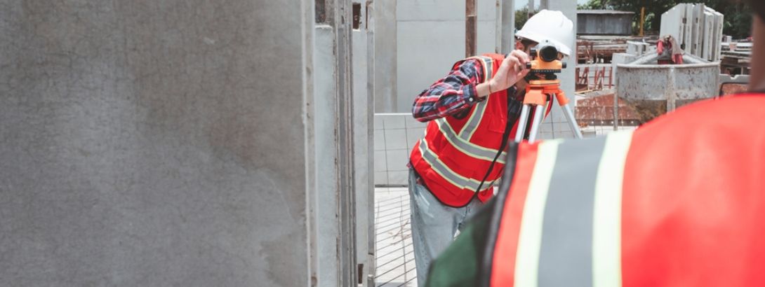
Every large infrastructure project begins long before construction equipment reaches the site. Before any engineer designs a structure or a drone captures the aerial layout, a deeper question must be answered: Is the ground safe enough to support what we plan to build?
This is where geotechnical investigation becomes essential.
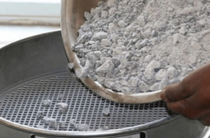
It is a scientific process that studies soil, rock, groundwater, and subsurface conditions to understand how the earth will behave under structural loads. For large projects like metro rail systems, highways, and bridges, this step is not optional. It forms the backbone of safe, feasible, and long-lasting infrastructure.
Across the country, the need for accurate testing has increased significantly, leading project developers to rely on experienced geotechnical companies in India. These companies offer critical insights that influence design decisions, construction sequencing, and project costing. Without proper geotechnical data, even the strongest design may fail because the land beneath it was not properly understood.
Why Metro Rail Projects Need Rigorous Geotechnical Investigations
Metro rail systems are among the most complex infrastructure projects India undertakes. Whether it is tunneling, elevated corridors, underground stations, or viaducts, metro construction requires a precise understanding of what lies beneath the surface. This is why geotechnical investigation work for metro rail projects India is far more detailed than standard construction testing.
Metro systems run across dense urban landscapes where soil conditions may change suddenly within short distances. Engineers must know whether they are dealing with soft clay, hard rock, loose sand, or groundwater pockets. Even small variations can affect tunnel stability, pier depth, and the safety of nearby buildings.
For underground metro sections, soil stability and rock quality directly impact tunneling methods, excavation risks, and the type of tunnel boring machines required. For elevated metro structures, geotechnical tests identify the exact depth and type of foundation needed to safely support large piers. In both cases, accurate geotechnical findings help prevent settlement, vibration issues, and structural failures.
Experienced geotechnical engineers also assist in evaluating risks such as sinkholes, liquefaction zones, and shifting soil layers. These risks are impossible to detect without proper investigations and cannot be ignored when passenger safety and long-term performance are on the line.
How Geotechnical Investigations Influence DPR Preparation
A Detailed Project Report, commonly known as a DPR, is the master document that determines the technical, financial, and environmental feasibility of a project. From highways to bridges and expressways, no DPR is considered complete without proper geotechnical data. For large transportation projects, engineers depend on detailed project report DPR highway bridges India to finalize alignment decisions, structural design, and cost planning.
Geotechnical investigation provides the foundation-level information needed for highway and bridge DPR preparation India. Soil strength, rock quality, fault zones, groundwater depth, and slope behavior play a major role in determining the type of foundation, the depth of piles, and the design of embankments or retaining walls. Without this knowledge, the DPR would be based on assumptions rather than facts, increasing the chances of cost overruns and structural issues during execution.
Well executed geotechnical studies help engineers calculate risk mitigation costs in advance, determine safe excavation methods, and choose materials that match the ground conditions. This ensures that the DPR is not only technically sound but also realistic and future proof.
Importance of BIM in Infrastructure Design
As infrastructure projects become larger and more complex, engineering teams are shifting toward digital planning models. BIM, or Building Information Modeling, is transforming how projects are visualized, designed, and coordinated. Today, BIM and design consultancy infrastructure India plays a major role in metro rail and highway development.
But BIM is only effective when it is fed with accurate real-world data. This makes geotechnical investigation indispensable to BIM design consultancy for infrastructure projects India. Soil layers, rock profiles, groundwater behavior, and load bearing values must be integrated into the BIM model to create accurate 3D and 4D simulations. These models help engineers test design variations, predict risks, and optimize construction planning.
When BIM teams collaborate closely with geotechnical engineers, they can visualize how the soil interacts with structural elements, identify weak zones early, and redesign components before construction begins. This integration reduces errors, improves construction sequencing, and enhances overall project safety.
How Geotechnical Studies Support Safer Highways and Bridges
Highways and bridges extend across vast distances, passing through varied landscapes that may include valleys, hills, rivers, and unstable terrain. In such projects, overlooking subsurface conditions can lead to dangerous consequences. Accurate geotechnical investigation helps designers understand slope stability, foundation depth, riverbed behavior, erosion risks, and seismic sensitivity.
Engineers rely on geotechnical analysis to design embankments, select pavement thickness, and determine the right type of bridge foundation, especially in flood-prone regions. These decisions cannot be made without clear soil and rock data. When geotechnical findings are properly integrated into DPRs and BIM models, highway and bridge designers can make smarter, safer, and more economical choices.
Local Expertise Enhances Geotechnical Accuracy
While national experience is important, local geological knowledge is equally valuable. Many infrastructure developers prefer working with regional experts because they understand the common soil patterns, seasonal shifts, and groundwater challenges specific to the area. For example, geotechnical engineering Salem Tamil Nadu provides deep insight into the unique rock formations, laterite soil behavior, and monsoon-driven groundwater changes in the region.
Such localized experience helps engineers anticipate problems before they arise, plan accurate foundation strategies, and design structures that remain safe in the long run. The combination of local knowledge and national-level capability makes geotechnical investigation far more effective.
Ensuring Long-Term Stability Through Better Ground Understanding
Geotechnical investigation is not just a technical step. It is a safety measure that protects lives, prevents construction failures, and ensures that large public investments remain stable for decades. Whether it is a metro rail corridor, a national highway, an important bridge, or an urban transportation network, every project depends on the integrity of the ground below.
By partnering with reputed geotechnical companies in India, developers gain access to accurate data, professional interpretation, and modern tools that help guide safe construction practices. High quality geotechnical studies reduce uncertainty, support better design decisions, and eliminate avoidable project risks.
Final Thoughts
Metro rail and DPR projects represent some of the most significant infrastructure investments in the country. Their success depends heavily on how well the ground is understood before construction begins. Reliable geotechnical investigation ensures that foundations are designed correctly, risks are identified early, and structural stability is maintained for generations.
From geotechnical investigation work for metro rail projects India to highway and bridge DPR preparation India, and from BIM-driven design to region-specific engineering insights like geotechnical engineering Salem Tamil Nadu, every step relies on accurate ground data. Choosing the right geotechnical partner is not just a requirement, but a commitment to safety, efficiency, and long-term resilience.
![]()